Platform adds support for route geofence
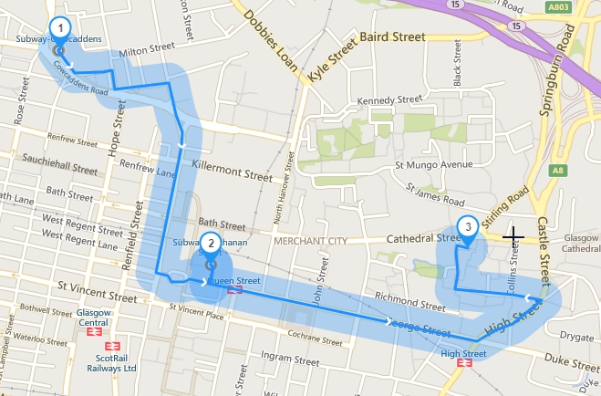
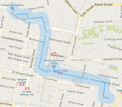
The path geofence refers to a fence delineated by a graph along a route as the center and a fixed distance as a radius. It can easily confirm whether the vehicle is driving on a certain route at a certain time.
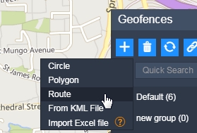
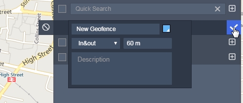
To establish the geofence of the route, you first need to select route in the new geofence type, and then draw the geofence of the route according to the pop-up prompt. Double-click the map to determine the locations that the route will pass through. The platform calculates the route through these points.
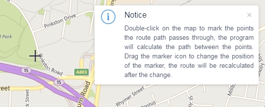
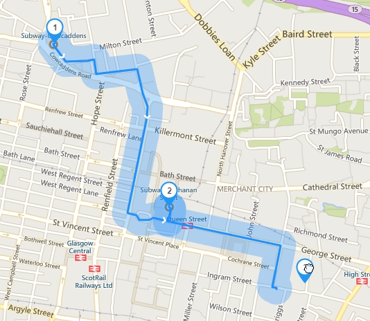
You can drag the icons of these points to change their position, and the route will be recalculated after changing the position.
You can adjust the radius covered by the path geofence, the larger the radius, the larger the range covered by geofence.
After editing the geofence graphic, click the button to submit. After the submission is successful, a new route geofence is generated. Other operations are similar to binding the device, editing the name color, etc., the same as the original geofence.
New features are introduced here.If you have any good suggestions, please log in to the platform and leave a message on the suggestion channel.